The British Library
ArcGIS, QGIS or web apps can simply use this map with web map services. WMTS, TileJSON or XYZ tiles are provided for quick access to processed maps.
Sign in to get links.
Overlay & compare
iiif viewer, iiif info json
Website
11248727335
flickr2
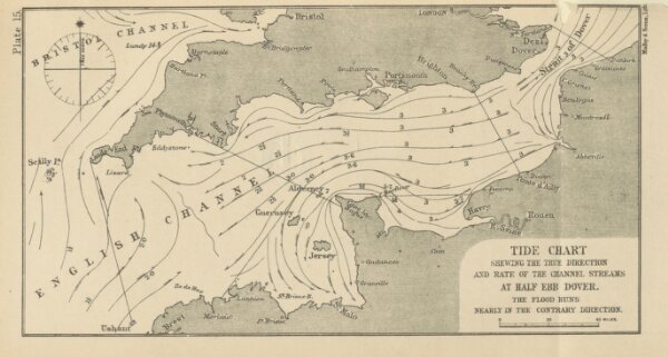
Book: The Pilot's Handbook for the English Channel ... Thirteenth edition. Revised to present date by Commander T. A. Hull
1898
King, John William.
J. D. Potter
147 × 274.7 cm