The British Library
ArcGIS, QGIS or web apps can simply use this map with web map services. WMTS, TileJSON or XYZ tiles are provided for quick access to processed maps.
Sign in to get links.
Overlay & compare
iiif viewer, iiif info json
Website
11229930273
flickr2
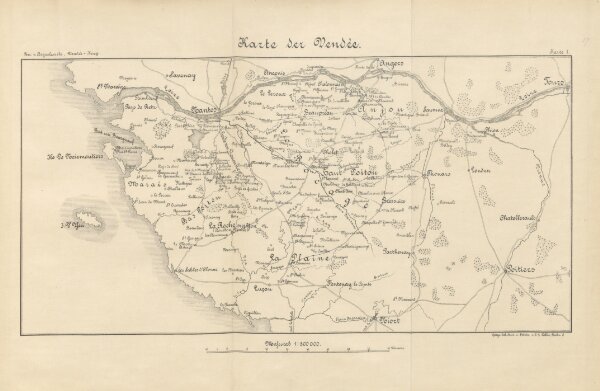
Book: Der Krieg der Vendée gegen die französische Republik, 1793-1796 ... Mit Karten und Plänen
1894
BOGUSLAWSKI, Albert Karl Friedrich Wilhelm von.
429.4 × 279.6 cm