The British Library
ArcGIS, QGIS or web apps can simply use this map with web map services. WMTS, TileJSON or XYZ tiles are provided for quick access to processed maps.
Sign in to get links.
Overlay & compare
iiif viewer, iiif info json
Website
11166364263
flickr2
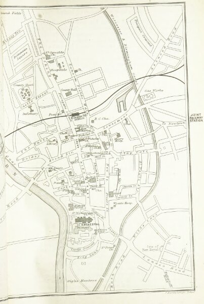
Book: Black's Road and Railway Guide to England and Wales. Fourteenth edition
1884
BLACK, Adam Publisher, and BLACK (Charles) Publisher
127.7 × 190.2 cm