The British Library
ArcGIS, QGIS or web apps can simply use this map with web map services. WMTS, TileJSON or XYZ tiles are provided for quick access to processed maps.
Sign in to get links.
Overlay & compare
iiif viewer, iiif info json
Website
11008009154
flickr2
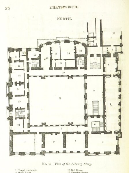
Book: The Peak Guide; containing the topographical, statistical, and general history of Buxton, Chatsworth, Edensor, Castlteon [sic], Bakewell, Haddon, Matlock, and Cromford; with an introduction ... Edited by T. Noble
1830
GLOVER, Stephen of Derby
136.3 × 183.1 cm